A spatio-temporal cross-scaling model of precipitation
Publié par Institut des Géosciences de l'Environnement IGE, le 1 juillet 2021 2.4k
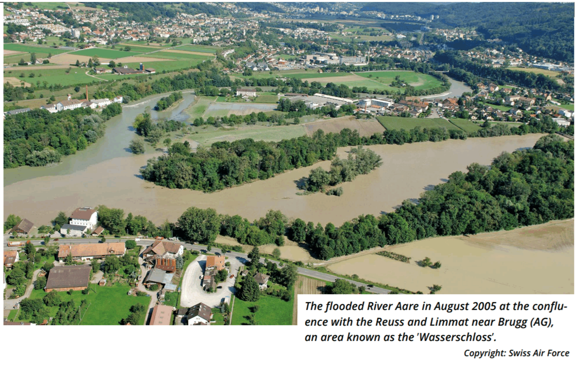
Extreme floods pose serious hazards worldwide, and the assessment of such hazards is of significant interest. However, such assessments require very long time series of data such as rainfall. Unfortunately, such data are typically not available, because most locations do not have recorded observations or, when available, cover a couple of decades only.
Rainfall is random in nature, and so some elements of statistics have to be employed. The rainfall, however, depends on how large the area is, and whether it falls for a short or long duration.
Two problem arise when using rainfall data. First, rainfall measurements are available only for some specific time steps. For instance, 1 hour or 1 day. What if for a design, we need rainfall at a particular time step, but we don't have that measurement at that particular time step? What can we do? We need a model, "a temporal scaling model", that when modelled, will give realistic and reliable rainfall measurements at time steps, beyond what we have measured.
The second issue is that rainfall measurements at station scale are not useful in itself. We need rainfall values expected over an area "areal rainfall". Radar measurement gives rainfall at a time step of 5min, over an area of 1km2. They are however not as accurate, and are not available for a long duration compared to point observations.
Combining this two (radar and point observation) will thus allow one to have rainfall series for a range of time step and for a range of area: a "spatio-temporal scaling model".
My Ph.D. has to do with developing a spatio-temporal scaling model for Switzerland, that will give the desired rainfall amount (whether small or very large), for a given area and a given duration. Over time, given the model I will develop, one might ask : what rainfall amount can I expect for an area of 1 or 1000km2 in 30 minutes or in 3 days ? The model will then give all the possible rainfall amounts (from small to large), that are likely to occur over the given area and the given duration.
This type of model is called Intensity-Duration-Area-Frequency (IDAF) model. It gives rainfall amount or intensity (I), of a given duration (D), falling over a given area (A), depending on how frequently it occurs (F).
Presently models exits that can give only large values of rainfall for a given area and duration. My model would give not only large values, but small and medium values. This is of keen to designers and modelers in the field of water resources for anticipation and design.
This Ph.D. is part of the project « Extreme flood events on the River Aare and Rhine » (EXAR) that is aimed at the development of long series of data such as rainfall and temperature for the reliable assessment of hazards posed by extreme flood events all over Switzerland. This would be an important basis for decision-making in order to protect life and infrastructure.
This article was written by Abubakar Haruna, a 1st year PhD at the IGE